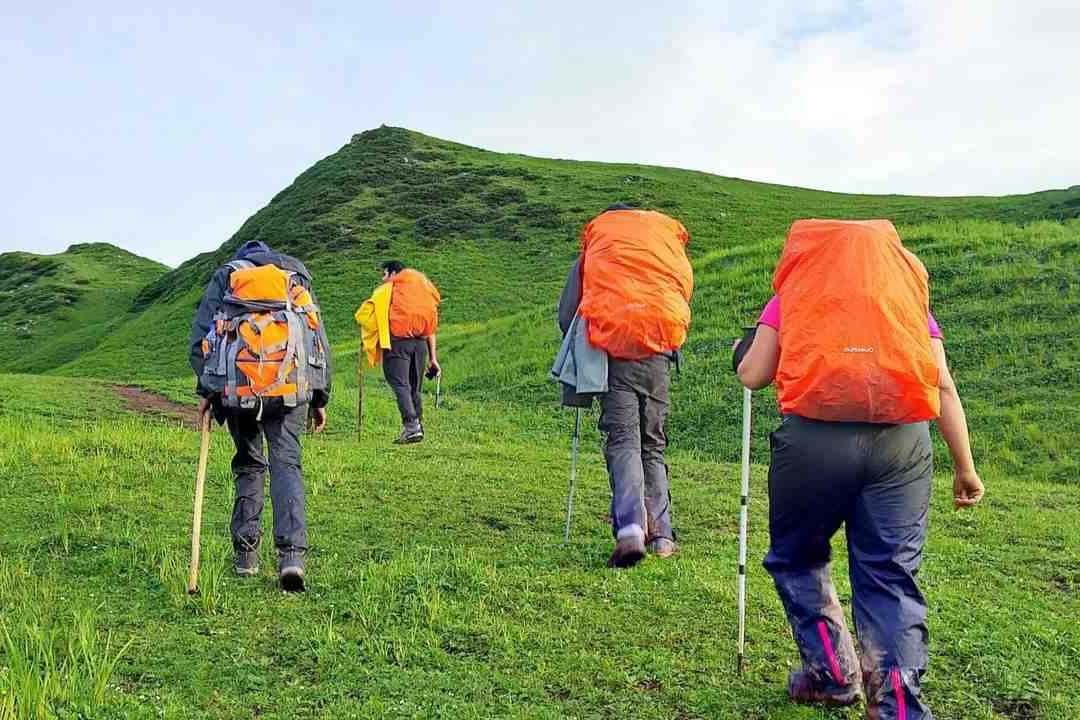
Pin Parvati Trek is a thrilling crossover with beautiful natural passages in Himachal Pradesh. A demanding but rewarding trekking point for trek lovers. It takes you through thick lush green forests and fields of beautiful flowers during the trek. Relish the adventure and natural beauty deep within your soul by indulging yourself in one of the most beautiful Himalayan treks.
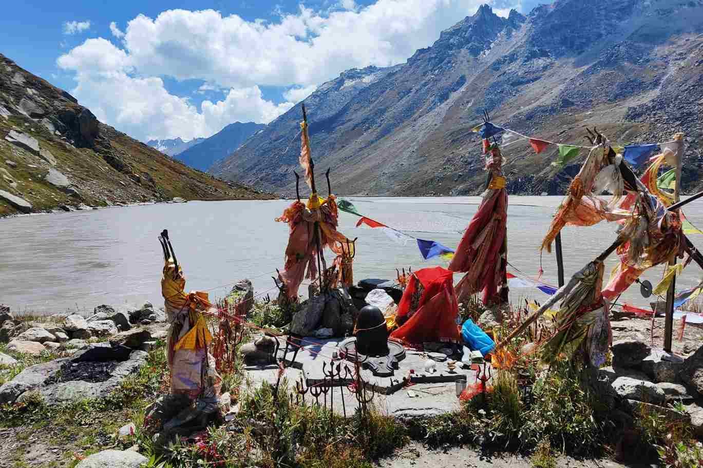
The Pin Parvati Pass Trek is wrapped under lush green forests and mighty deep green valleys. It is an alternate passage to Himachal Pradesh’s Spiti Valley. Interestingly, the Pin Parvati Pass Trek is one of the enthralling & most challenging treks in North India. The height of Pin Parvati Pass Trek is almost 17,457 feet & on the way, you can visit Mantalai. Mantalai is an old Lord Shiva Temple that devotees visit during the trek. Likewise, it has a charming lake that can rejuvenate you while you are on trek. Relax, spend some time sitting near the lake. Overall, this trek will take you to a heavenly journey of nature. Likewise, you will forget all the hustle and bustle of city life.
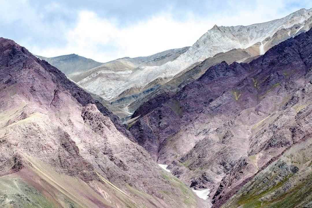
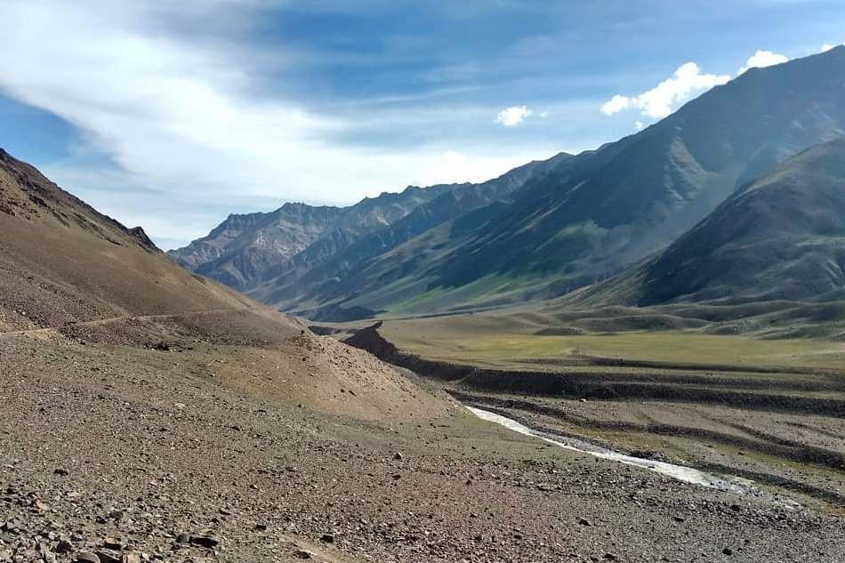
Pin Parvati Pass is one of the toughest cross over treks of India. It is meant for seasoned trekkers who are looking for constant thrill and challenges during the trek. Interestingly, it provides the most spectacular traverses from the forest to the Buddhist villages in Spiti valley. Likewise, the Pin Parvati Trek route offers views of Buddhist villages, landscapes, cold dry mountains and lots more. Within a few hours, you will reach the mountain desert region of Spiti and the rich biodiversity in Parvati Valley.
After you trek so hard, you will get to explore the greenery, the beautiful and colorful flowers of Odi Thach, dense forests near Kheerganga and glaciers. Also, you can explore Parvati Kund. During the trek, you can also experience the hot water bath. It is known to give a five star sauna experience which is seldom available on any Himalayan Trek spot.
Catch an overnight bus from Delhi and reach Manali the next day. You will be receiving the pick up facility from Manali at around 6 am. Since the Rohtang pass and Kunzum pass are known for their notorious traffic, it is recommended to leave early. It will probably take 10 to 12 hours to reach the Base Camp, Kaza. Today, you will take a rest and relax with camp members.
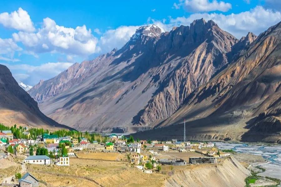
Kaza is the base camp from where you will be traveling to Kibber. The distance between Kaza and Kibber is about 1 hour. Kibber is the most historical and wonderful village that has cultural values. Kibber village is known as the highest inhabited place in the world. The village is home to snow leopards and Siberian Ibex. It has typical Himachali-style homes. It is indeed fun to explore the village.
Day 2 will be spent as acclimatization. It will be necessary to spend one day in Kaza to adapt to the weather conditions as the oxygen level will be lower. You cannot start the trek as soon as you reach it as it can lead to asphyxiation and it can become severe. Therefore, relax and explore nearby places.
From Kaza, you need to drive to Mudh village. Mudh is about 48 km away from Kaza. It takes almost 3 hours to reach Mudh. From Mudh village, you will be starting your trekking journey. After trekking for 3 hours, you will reach Tiya.
Mudh village is beautiful and it gives you the most delightful trekking as compared to other treks. There are no villages in between till you reach Parvati valley.
On the fourth day, you will be traveling to Shia from Tiya. You must start trekking as early as possible. On the way, you will go through glacial streams. The glacial streams become hard while crossing during the midday. You will have to walk a long distance and go via ice-cold streams which will make the feet freeze.
You need to be careful as Shia is a landslide prone area.
On the fifth day, you will start by crossing the cold pine rivulet. It is a bit difficult to cross the pine river as it is cold. The river bed consists of hard rocks and pebbles on the way. Hence, it is necessary to be careful while crossing the river bed.
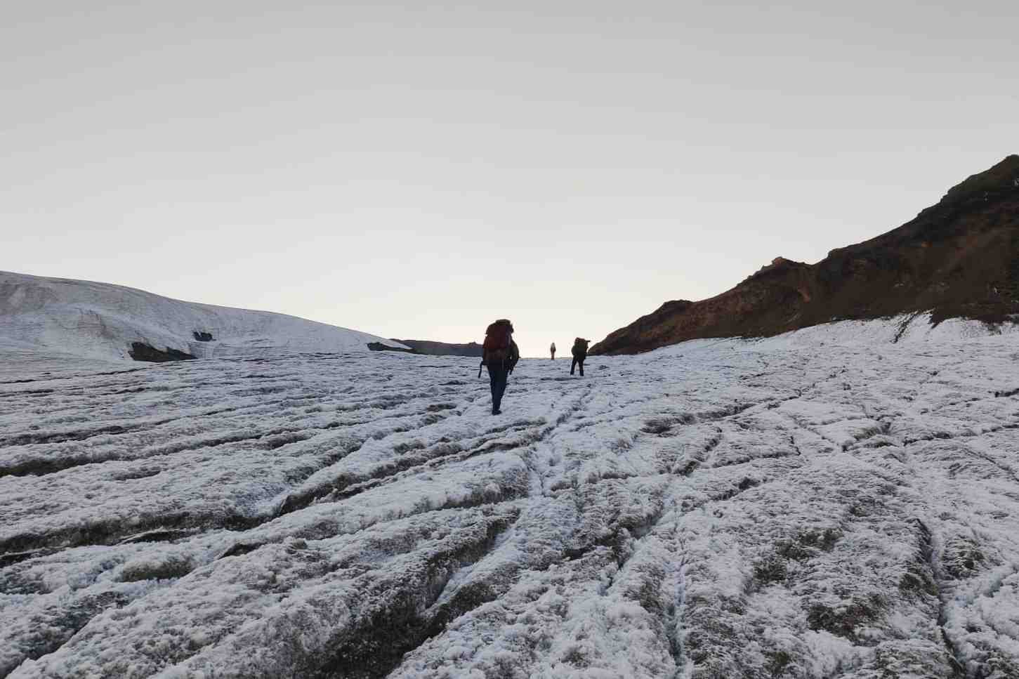
Once you cross the river, you will trek for 5 to 7 hours on a steep mountain with a height of 1,700 ft. It's difficult to climb a steep ascend so you have to be careful. You will be set up at the Pin base camp. Pin base camp is situated 1,000 ft below the Pin Parvati pass.
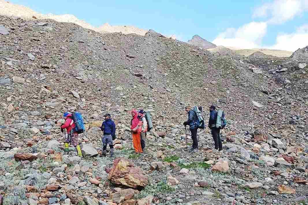
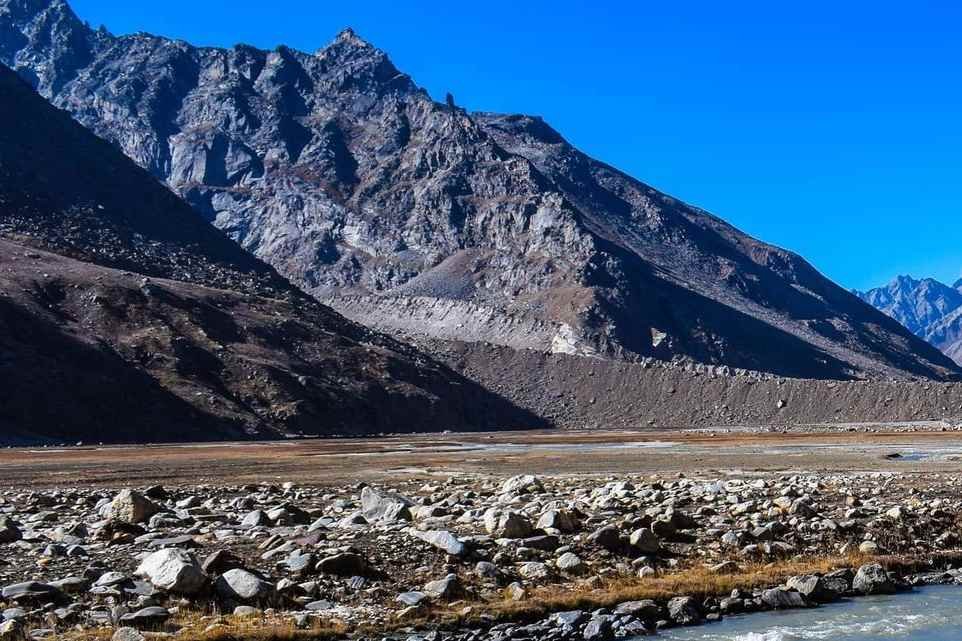
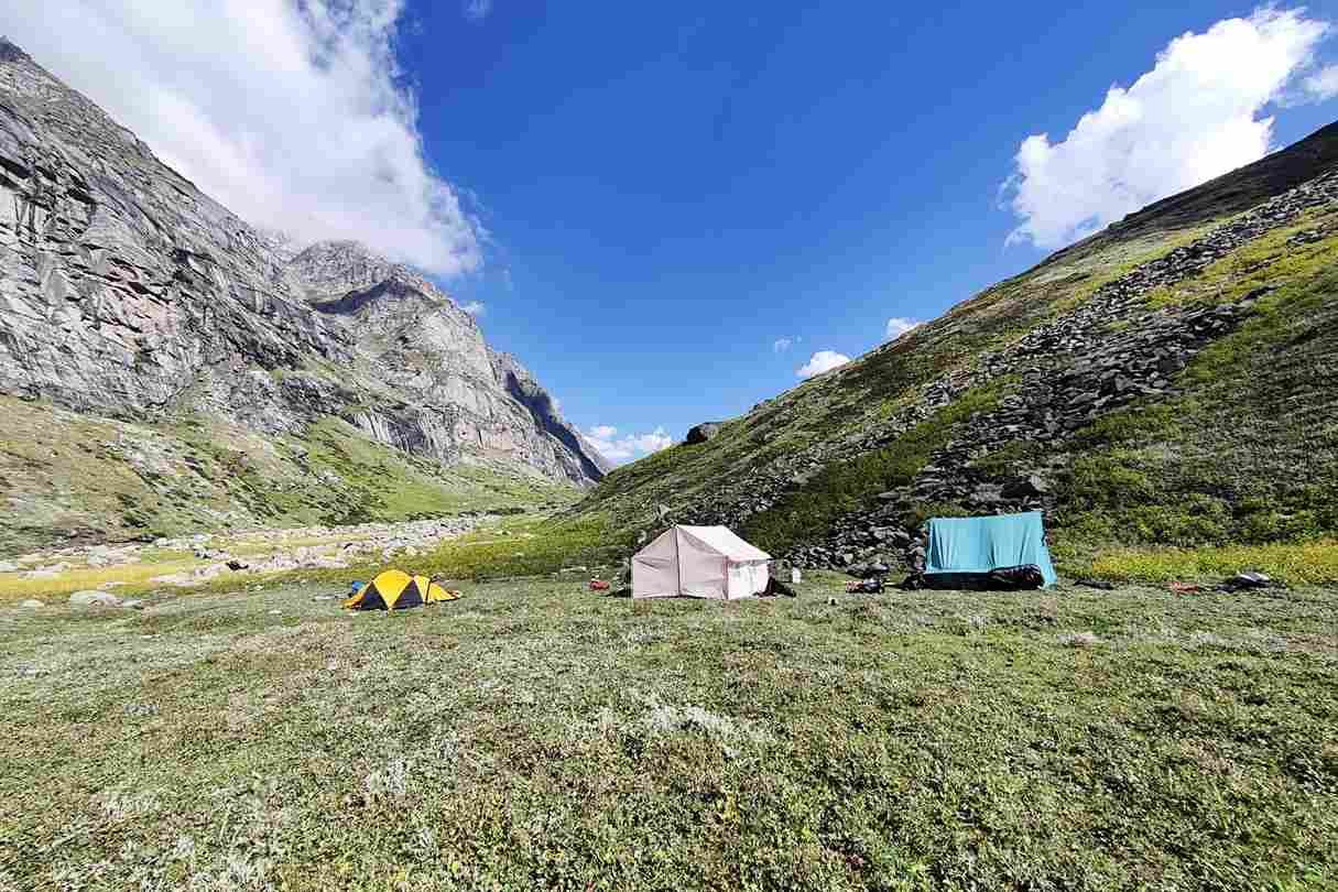
You need to pass the Pin base camp as soon as possible. This is because as the day passes, it becomes difficult to pass. It is indeed an incredible experience on the Parvati Pin. The view of Parvati Pin is mesmerizing and you can cross Parvati glacier which is entirely crevasse. The Parvati base camp is similar to the Pin base camp and it is a chilled place. Later on, you will go towards Mantali. Mantali is stream, steep, and boulder.
You need to cross ice-cold water barefoot at Mantali with all rocks and pebbles. Once you reach, you will set up a campsite and campfire and enjoy with the trekking buddies.
On the seventh day, you will wake up to the most amazing and alluring view. The beauty of the campsite is very unique and it will rejuvenate you. The glorious sunrise and calming sunset make your day worthwhile during camp.
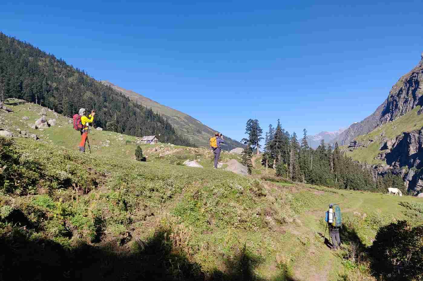
The next morning on the eighth day, we will be heading towards Thakur Kuan. In between, we will be passing through the prettiest and one of the easiest downhills viz Meadows of Odi Thatch. You will come across multiple terrain regions and finally, you will cross multiple streams. Further, you will be able to find the Parvat rivulet on the left side and it is indeed very attractive. Also, you will get to explore big forest areas and beautiful meadowland. From here, you will enter the Thakur Kuan region. Thakur Kuan is a region surrounded by orchid flowers, plants, and small trees.
The Pandu bridge is something you need to cross while reaching Thakur Kuan. It is the most tricky patch that comes 2.5hours after the start of the trek. It is highly recommended that trekking groups must stay together.
There are many water points you can explore and also do camping activities here. You will reach Thakur Kuan and which is at a height and altitude of about 11,700 ft above sea level.
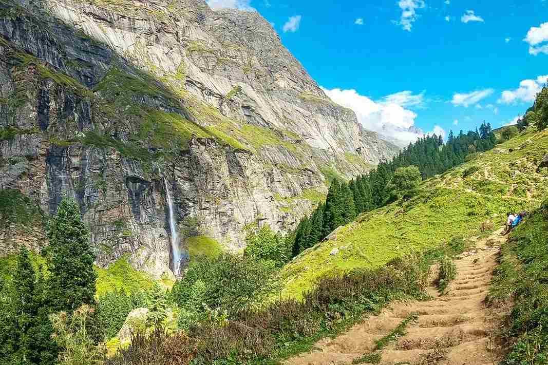
The next day we will initiate a trek to Tunda Bhuj. The trek is a narrow and slippery path that directs you to the valley floor. Tunda Bhuj is a meadow steeply. You can get spectacular and amazing views of nature, waterfalls, black rocks, and valleys. You can stay here in Tunda Bhuj for the night, and enjoy camping and dinner with trekking partners.
You will be initiating your day by crossing the bridge near the Parvati rivulet. Also, you will be going through many pasture lands and empty trails. Also, you will find the open lands of the Parvati valley. The first trail is known as the Ramkund trail.
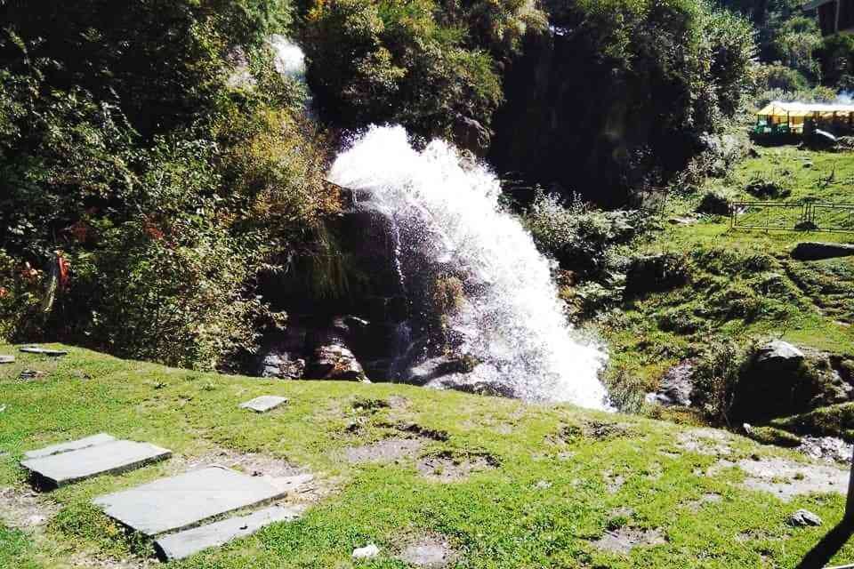
Further, you will find civilization-like small huts of residents. You will also find a Dhaba near Kheerganga. When you reach Kheerganga, you will like the trekking as there are many restaurants and cafes. Also, you will find people for trekking. You can enjoy nature and play music while trekking. You can also jump into a hot water spring and have a marvelous experience.
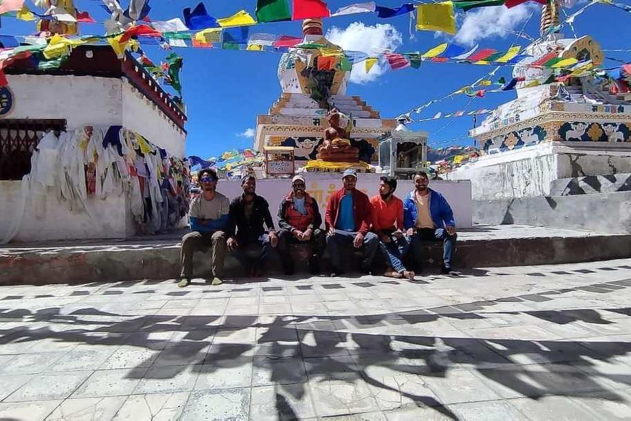
It is indeed the last day of trekking along with traveling 7 km. You need to reach Barshaini from Kheerganga. There are several buses from Barshaini to Kullu. You need to pay additional charges for a trip to Kullu. It takes almost 3 hours to reach Kullu. On the same day, you can leave for your home.
The buffer day is the day where, if you wish, you can stay in Kullu to explore the places and beauty of the same. It is kept as an option and you need to spend additional charges for the buffer day and extra day to stay in Kullu.
Q. When is the Best period for the Pin Parvati Trek?
Best timing for the Pin Parvati Pass trek falls between July and September, specifically during the summer months. During this period, the trails are clear, facilitating relatively easy navigation through any potential obstacles.
Q. What should I consider before going on the Pin Parvati Trek?
The Pin Parvati Pass Trek poses a considerable challenge. For those venturing into trekking for the first time, it's crucial to be well-prepared. Ensure you pack essentials such as a backpack with a rain cover, water bottles, a torch, a medical kit, a walking stick, snacks, and a wind- and waterproof jacket.
Additionally, establish a fitness routine focusing on leg and core muscle workouts to endure prolonged periods of walking and climbing without succumbing to fatigue.
Prior to the trek, consult with a doctor to address any underlying medical conditions, and carry necessary medications and essentials accordingly.
Q. Is the Pin Parvati trek considered safe?
The Pin Parvati trek is highly safe when conducted under the supervision of experienced trekking professionals. However, it is not recommended for individuals attempting their first trek or those new to hiking in the Himalayas.
Q. What is the distance covered during the Pin Parvati trek?
The Pin Parvati trek typically spans an average of 6 to 7 hours per day. The initial day involves a 10-hour drive from Kullu to Barsheni village. Subsequently, daily treks of around 6 hours lead to Thakar Kaun, and to reach Mantalai, there is a trekking distance of about 12 hours, which includes crossing the Pin Parvati Pass. The remaining days vary in trekking hours, ranging from 4 to 10 hours. In total, the trek covers an approximate distance of 110 kilometers, considering both the drives and trekking segments. The maximum altitude reached during the trek is 17,500 feet.
Mount Friendshipp Peak in Manali becoming more famous for experience trekkers and beginners, this Expedition wil
View Details