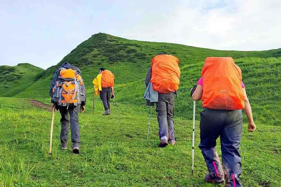
Lahaul has been lately recognized as a trekking place by trekkers. Until now, the Lahaul region was closed for trekking purposes because of a lack of transportation facilities. With the inauguration of the Atal Tunnel, it is now possible for trekkers to visit the Lahaul region easily. Miyar Valley Trek is an easy to moderate level trekking trail.
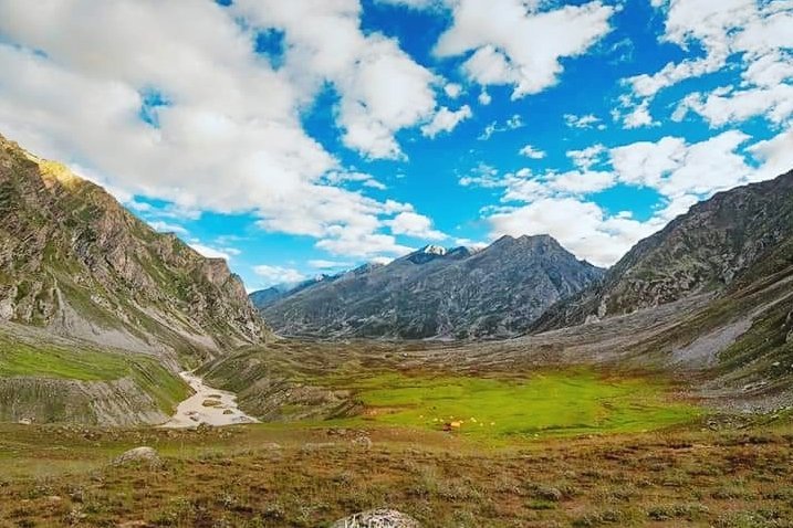
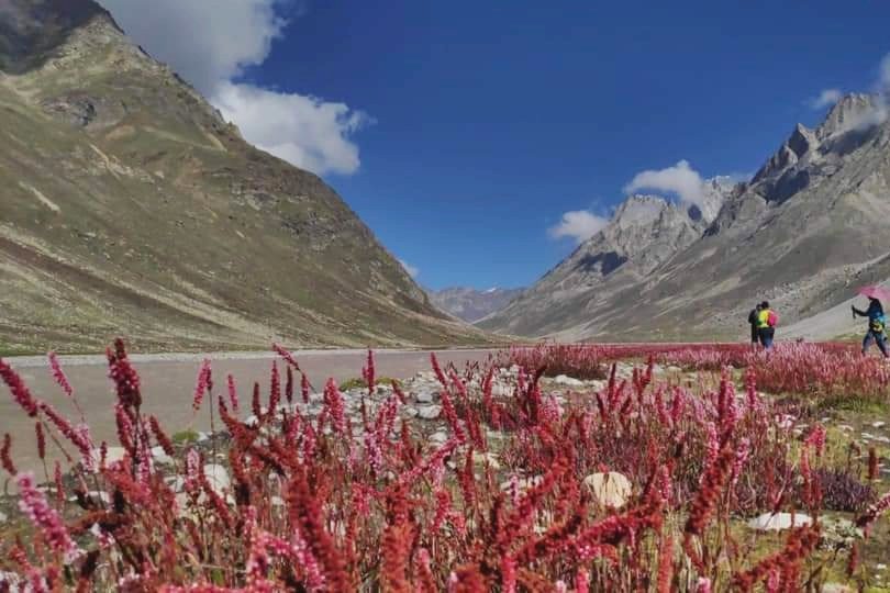
Spectacular views of lush patches of the Lahaul region with dancing flowers capture your mind. You have to trek through huge mountains and valleys passing by small hamlets and flower beds. Miyar Valley is full of colorful and beautiful flowers like Himalayan orchids and others. This sprawling valley spreads to an area of more than 100 km beginning from Udaipur in Himachal Pradesh to the great Kang la pass.
Miyar Valley has a variety of plantations such as Barley and green peas. You will explore the enchanting beauty of this valley during monsoons. Your trekking route will be amazing with the views of Miyar valley on one side and small villages on the other side. It is like a fairytale to trek through this gigantic valley.
This valley has an S-shaped route and you have to spend around 8 days to complete this trek. You will get some of the toughest challenges on your trekking route. But it is a lifetime experience for any trekker to finish Miyar Trek valley.
You can pick a period from June to September to visit Miyar valley. In June and July, it is summer in Lahaul valley. The average temperature is around 15 degrees Celsius throughout the day. During the summer season, you will find heavy snow at a higher altitude. The region is dry and it is easy for trekkers to walk on different routes.
If you love trekking in cold weather, visit this valley during July. Monsoons leave a cold atmosphere in the region. Although it is cold in the valley, you will still not find snow on your route. The region has an average temperature of about 15 degrees Celsius in the daytime and 0 degree Celsius at night. You can visit this valley during summer or monsoons as per your comfort.
Today, we will start our trekking journey from Manali. As it is going to be a tiring day, you have to be mentally and physically ready for some challenges. We have to start driving in the morning from Manali in a vehicle to reach Udaipur.
Atal Tunnel is the only route where we can drive from Manali to Udaipur. On the way to Udaipur, we will get the sight of beautiful terrains, landscapes, and green areas. Lahaul is an epitome of beauty that you can explore on your journey. We will come across some of the most famous spots of Lahaul like Tandi and Triloknath Mandir.
Driving through Kullu and Lahaul regions is a dream come true. You will see the giant River Chenab flowing freely between steel mountains and rocky areas. Apart from that, you will also view many kinds of crops such as lettuce and others. Sissu’s waterfalls will calm your mind with their stunning beauty.
Tandi is the place from where the road connects to Leh Manali highway. You will also view the meeting point of Chandra and Bhaga Rivers. We will reach Udaipur around 4 pm. Today, we have to rest in our tents to get familiar with the local climate. Explore the local areas of Udaipur and click some pictures with your group. We will enjoy a beautiful and relaxing sleep in tents.
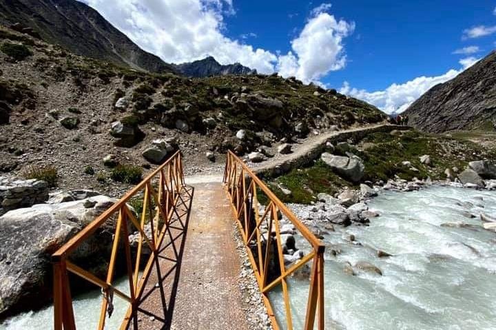
We will start our journey as usual in the morning from Udaipur. We have to drive from Udaipur to reach Shukto. The first place we will come across is Kanjer village after passing a suspension bridge. This village is situated at a distance of 31 km from Udaipur. Kanjeer village has 13 villages.
You will see 3 kinds of soil in this village. It also has different types of crops such as lettuce, tomatoes, and seed potatoes. Trekking near these farms gives you a unique lifetime experience. This region has a beautiful stream where you can fill your water bottles.
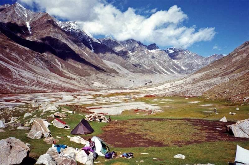
You will come across many steep rocks on this route. After walking on these steep rocky areas, we will reach the Doksa campsite. We will spend the whole day at the Doksa campsite with the amazing views of Menthosa.
Today, we have to take several descents in our journey. We will start to trek in the morning and pass some descents. Then we have to take an ascent and climb Stupa. On your way, you will see the changes in the colors of landscapes. It is an unforgettable sight for trekkers.
After crossing a bridge, we will cross many Juniper Trees. After reaching the stupa, we have to continue to walk on this path to reach the Thanpattan region. This region is blessed with fat meadows and the Rocky Mountains. It is a lovely region with captivating landscapes and scenic beauty.
After walking for some minutes, we will reach Tharang basecamp. Tharang has tree mountaintops that are viewable from Zardong. We will also get an opportunity to see the patch of purple fleece flowers. You will have to walk on several phases on this road.
Our campsite for tonight is Yoling. It is again a stunning place with a stream. You can spend a beautiful evening with your friends and watch the magic of colors changing in mountains.
We have to take a descent on our route. Then a climb will lead us to Stupa. From Stupa, we will see colorful landscapes in every phase. We have to travel downwards and cross a small bridge. After a descent, we will see numerous Juniper shrubs.
We have to still travel downwards to the Stupa. After walking for 20 minutes, we will reach Thanpattan. This region begins from a stupa and includes the Rocky Mountains and flat meadows. After passing Tharang basecamp, we will reach Zardong. This region is famous for purple fleece flowers called Lupins.
Zardong is our spot for spending the night. It is a wonderful place with mesmerizing nature and beauty.
As we do on other days, we will start our journey in the morning. We have to walk for some time to reach Gompa Nala. This area will take us to the region of boulders and then to Miyar Nala.
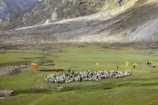
Today will be the most difficult day for all the trekkers. We have to walk on flat land and take a descent to reach a bridge. From this bridge, you have to climb on a steep slope to reach Gompa Nala. This area is surrounded by a shepherd’s house and a small water body.
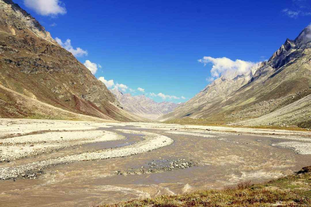
After taking a descent, you will come to a challenging portion. The route will take us to the boulder section. This section is very tough to pass because of the sharp edges at many points. You might feel tired while crossing this boulder section but the breathtaking views of the mountains will keep you fresh. We will take a descent to reach a flat area near the river.
As you move forward, the valley opens its large arms. You will see many kinds of flowers on this trekking trail. We will reach Palpu within a few minutes. It is one of the best campsites to spend a lovely time in.
Today, we have to walk across rivers and valleys. We will walk on a flat surface on this route. Chhudong region is located near the river. It is easy to cross this path for any trekker. After crossing the boulder section and cold stream, the trail becomes easier than before. You have to walk on any easy route.
Now, you will get a flat path on this route. This road also has a boulder section with few water streams. You can fill your water bottles from these streams. We will reach the Palpu region. Palpu is a good campsite located near Castle Peak. It offers a gorgeous view of the valley.
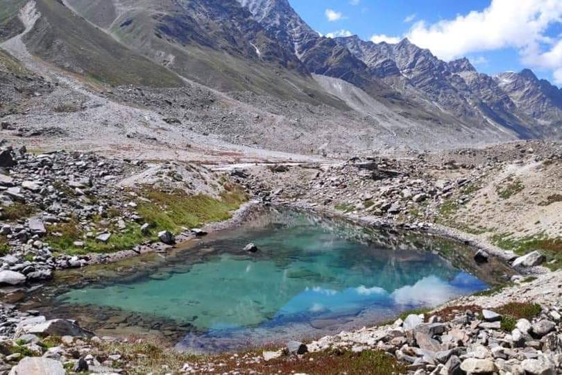
Today, we will visit the snout glacier. After crossing the boulder section and a stream, we will reach an area of small meadows near icy lakes. This region is known as Kesar Yon chu. You have to walk for about 30 minutes from these lakes to reach Kesar Yon Chu.
The snout is a lovely area where you can click some pictures. Then we have to take the same route that we took before. We will also come across 2 river crossings on our trekking trail.
The Chhudong area is flat. Now, we will reach Gompa by taking numerous ascents and descents. After this route, we will reach Gompa Nala. The trek is finally over.

As it is the last day, we will start trekking from Doksa to reach Shukto. From Shukto, we will drive to reach Manali. We will take the same road that we followed at the beginning of the trekking trail.
We will reach Manali by 2 pm. You can stay in Manali for seeing its true beauty
We offer the following items in our trekking packages:
We do not include the following items in our trekking packages such as:
If you want our help in carrying your luggage, you will have to pay some charges. Our charges for offloading backpacks are:
The weight of your luggage must not be more than 11 kg. No trolley bag or suitcase is allowed on trekking.
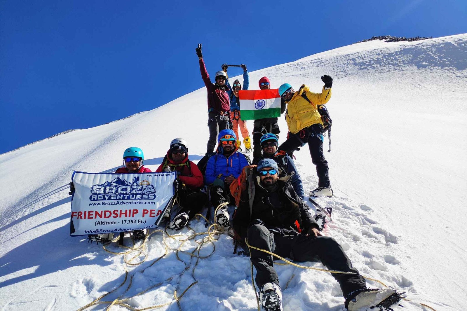
Mount Friendshipp Peak in Manali becoming more famous for experience trekkers and beginners, this Expedition wil
View Details